The height of New Zealand towns
NB: If you just want to know what towns are the highest, go to results!
Earlier in 2016 I was staying in St. Arnaud, a small alpine village situated on the doorstep of the Nelson Lakes National Park. The village is usually subject to much cooler temperatures than the nearby coastal cities, such as Nelson and Blenheim, due in part in its high altitude of ~640m.
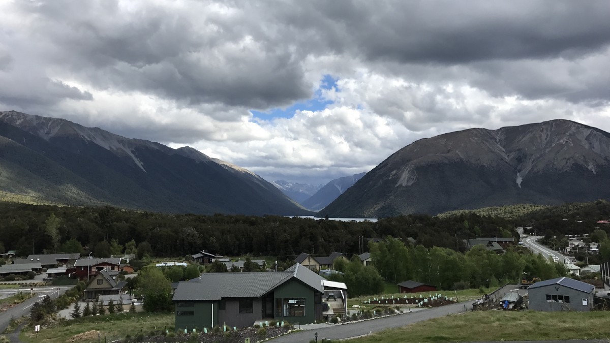 The alpine village of St. Arnaud, looking south towards Lake Rotoiti
That got me thinking: how many other settlements in New Zealand are at an equivalent or higher altitude? A quick search on the web revealed no answers, and a brief peruse of some topographic maps didn’t help any further. In fact, it surprised me to learn that many places I considered ‘alpine’ were in fact reasonably low, such as Queenstown (~320m) and Cromwell (~210m).
In order to figure out the answer to my question, I turned to the excellent desktop open-source GIS program, QGIS and some freely available data sources.
Data sources
Solving the problem required two main data sources (1) altitude information and (2) a polygon dataset containing populated places, as determined by some criteria of what a ‘populated place’ is.
Altitude
A quick glance at my usual source of elevation data, the “NZ 8m Digital Elevation Model” from https://data.linz.govt.nz, showed it to be unsuitable due to its large file size (31 GB), so I settled on using two 25m digital elevation models (DEMs) from Landcare Research:
- https://lris.scinfo.org.nz/layer/127-nzdem-south-island-25-metre/
- https://lris.scinfo.org.nz/layer/131-nzdem-north-island-25-metre/
Whilst acknowledging there are limitations with these DEMs, the resolution and interpolation methodology appear to be of suitable quality for this simple exercise.
Populated places
After having a look around, there appeared to be no authoritative source for New Zealand settlements and their boundaries. LINZ datasets existed for “NZ Place Names”, and Statistics NZ also had some boundary information, however none of it was particularly useful.
I eventually stumbled across a dataset titled “NZ Populated Places” (Peter Scott, https://koordinates.com/layer/3658-nz-populated-places-polygons/), in which the author had combined multiple data sources (from LINZ, OpenStreetMap, Zenbu, Koordinates, Statistics NZ) to create both a point and a polygon layer of populated places, defined as ”… settled areas, either urban or rural where densities of around 20 persons per hectare exist, and something is able to be seen from the air”.
The author noted a number of issues with the methodology and resultant dataset, commenting on overlapping polygons and the subjective nature of some decisions, however overall it appeared to be an appropriate source for approximating settlements.
Method
The elevation datasets were first cleaned up (merged, clipped and relevant values extracted), and the populated places dataset overlaid. The ‘zonal statistics’ tool was then used to calculate the mean value behind each ‘populated place’ polygon, thus approximating the altitude of each place.
Results
The following places were listed as having the highest average altitude:
- Whakapapa Village (NI) [1135m]
- Waiouru (NI) [821m]
- National Park (NI) [813m]
- Aoraki/Mt. Cook Village (SI) [759m]
- Arthur’s Pass (SI)[749m]
- Lake Tekapo (SI) [723m]
- Castle Hill Village (SI) [722m]
- Rangataua (NI) [668m]
- St. Arnaud_ (SI) [642m]_
- Onepoto (NI) [605m]
(NI/SI = North Island/South Island; altitude rounded to nearest metre)
Depending on the methodology used, the order of these places could change somewhat, but the results appear to make sense—the majority of the highest North Island places are on the North Island Volcanic Plateau, and the South Island places are all in the Southern Alps.
It could be argued that other places, such as ‘bach areas’ like Bealey Spur (near Arthur’s Pass) should be included, however as mentioned, defining ‘populated places’ can be somewhat subjective.
Conclusions
To answer my original question, there are about 8 populated places in New Zealand at a higher altitude than St. Arnaud. All of the highest places were reasonably small settlements, and ~75% of them had an altitude lower than 100m.
However, in terms of temperature differences altitude is simply one factor influencing the local climate—across New Zealand there is a spectrum of different climate zones, each influenced by factors including topography, latitude and proximity to the oceans. At some point it would be interesting to do some further investigation into climate zones, but that’s a task for another day!