Trip Report: In the shadow of The Haystack
In early January 2022, scarcely a week before my scheduled departure back to France, I organised a tramp with Dad to Larrikin Creek Hut. This would likely be the last tramp in Aotearoa I would do for a while, so I was keen to find a memorable spot for an overnighter!
After seeing a cool photo in a Wilderness Magazine, we set our sights on Larrikin Creek Hut, accessed via a trail that starts not far from Lake Matiri near the town of Murchison. It would have been cool to have had three days for this trip to take advantage of the potential day-walks from the hut itself, but given my time constraints we had to make it work as an overnighter.
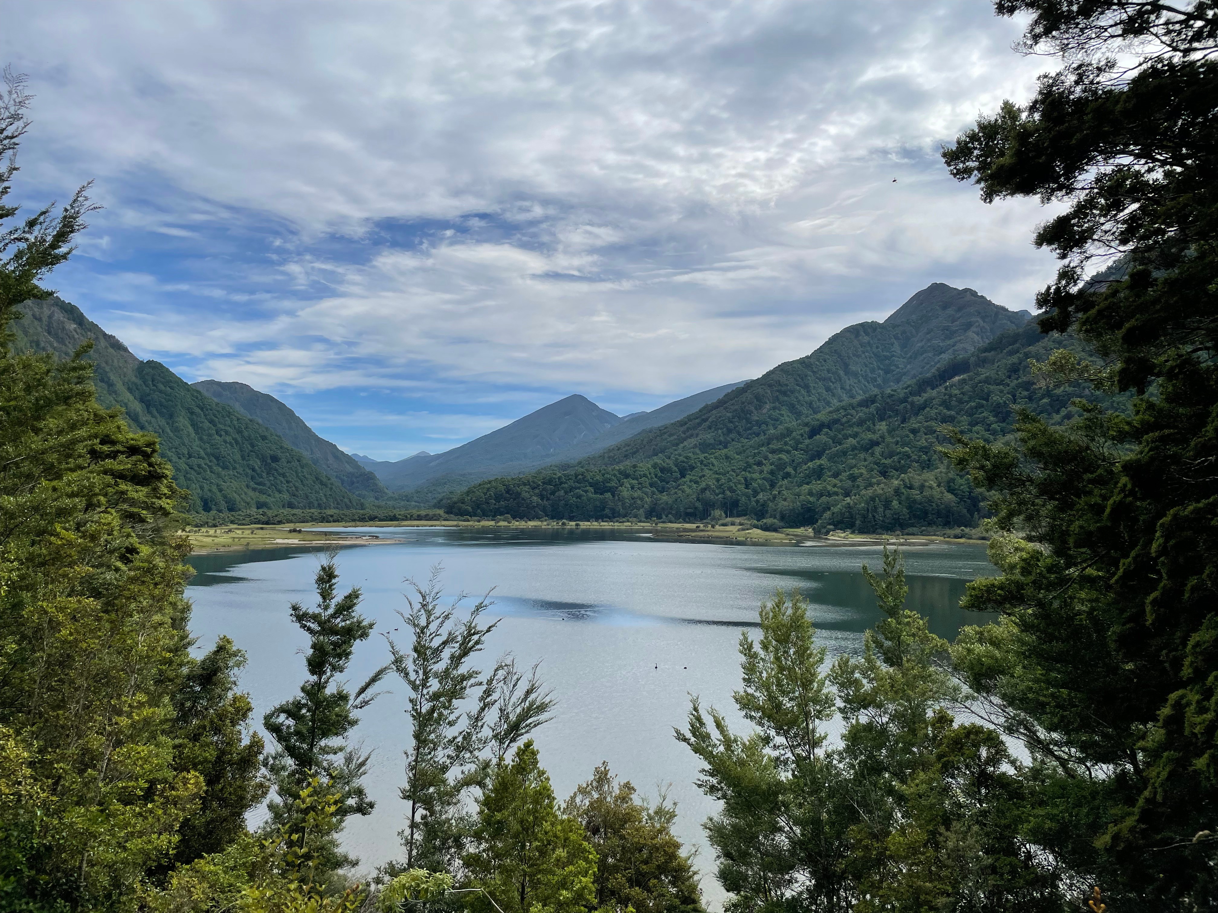 The view of Lake Matiri from the hut
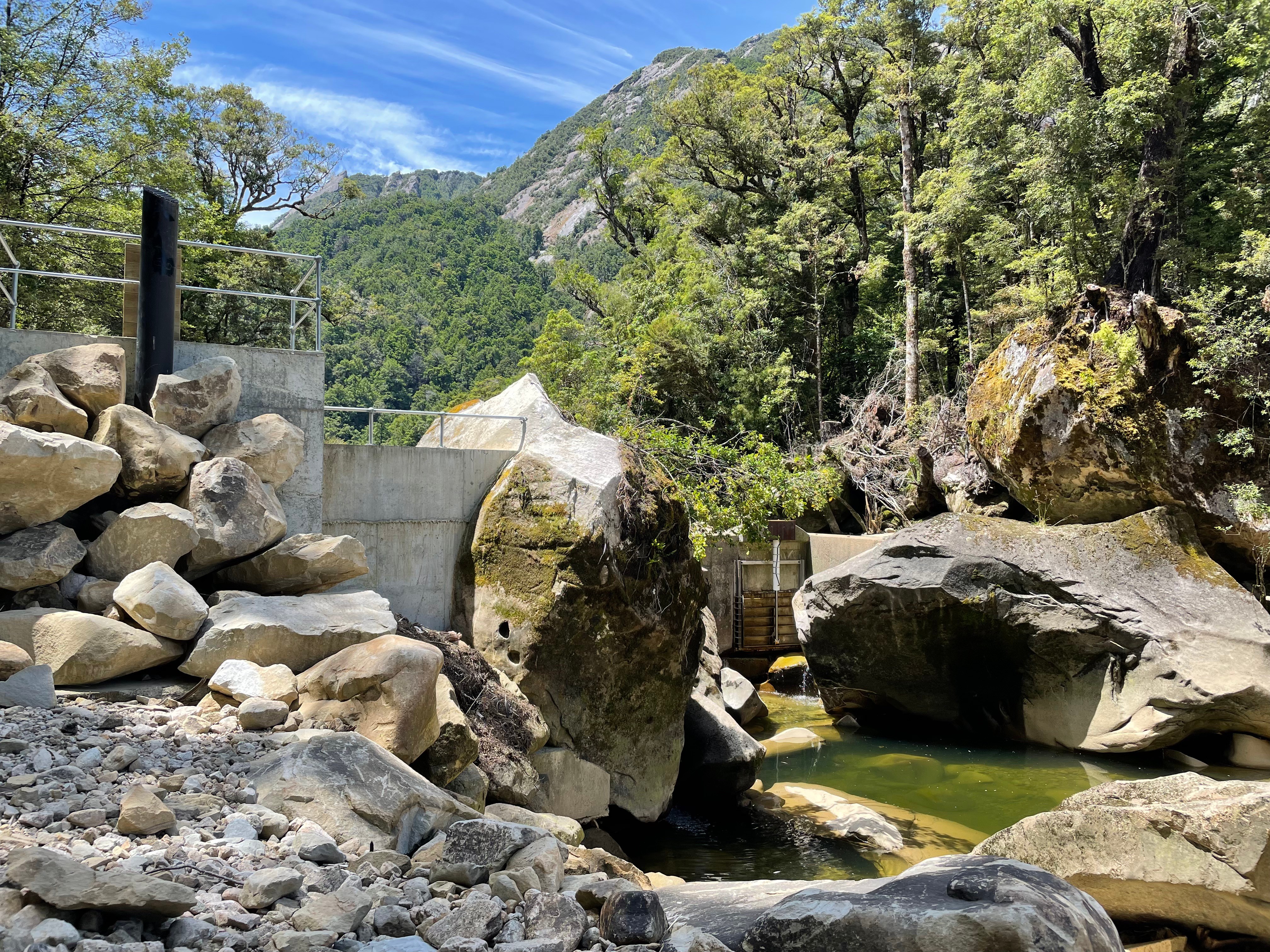
Arriving at the carpark (260m altitude) a bit before 9am, we started along a recently-constructed gravel road. The road and associated penstock were constructed for a weir-based hydroelectricity scheme situated on the southern edges of Lake Matiri. Despite being a human-made thing in a natural environment, it was interesting to see a newly constructed hydroelectricity project and later read about some of the techniques used to mitigate its environmental impact.
The well-built gravel road wound its way up the side of the valley, before taking us steeply up and over a small ridge. Eventually we turned off the road and onto a well-formed trail heading to the Lake Matiri Hut. After a quick snack and photo stop outside the hut (accompanied by a decent collection of wasps), we followed a trail down to the valley of the Matiri River West Branch. After an easy boulder hop, and some carefully chosen steps through a boggy section, we arrived at the bottom of a ridge that would take us up to the Thousand Acres Plateau.
From here began our very steep ascent. The first section took us up about 500m in less than 2km of walking, before levelling off, turning west and then descending slightly. Many short breaks were necessary on the way up, as one of us had not had the benefit of 3.5 months of tramping Te Araroa a year prior! One break near the top of the first ascent also happened to have an excellent view of Lake Matiri, now well below us.
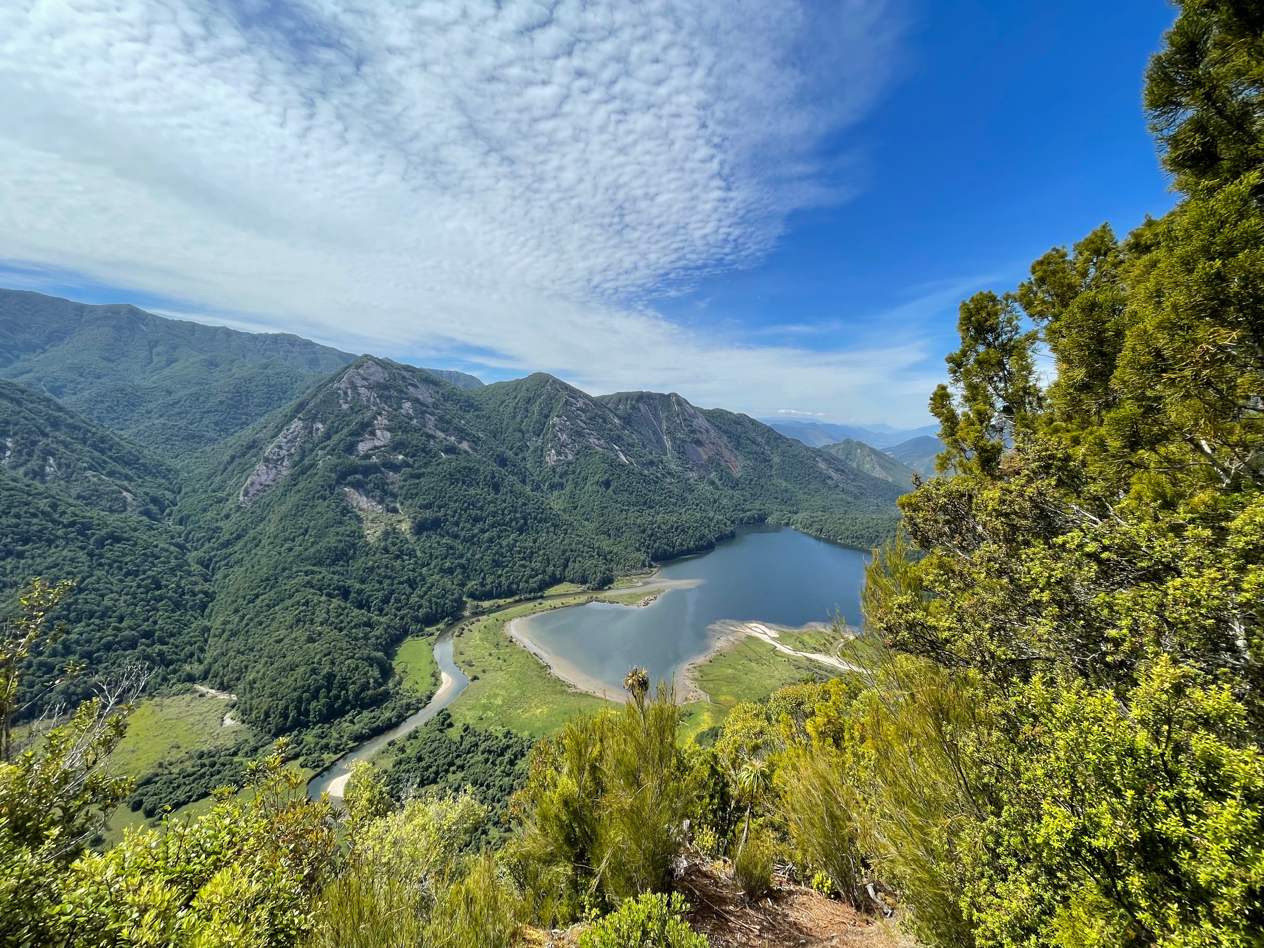 The excellent view of Lake Matiri from above
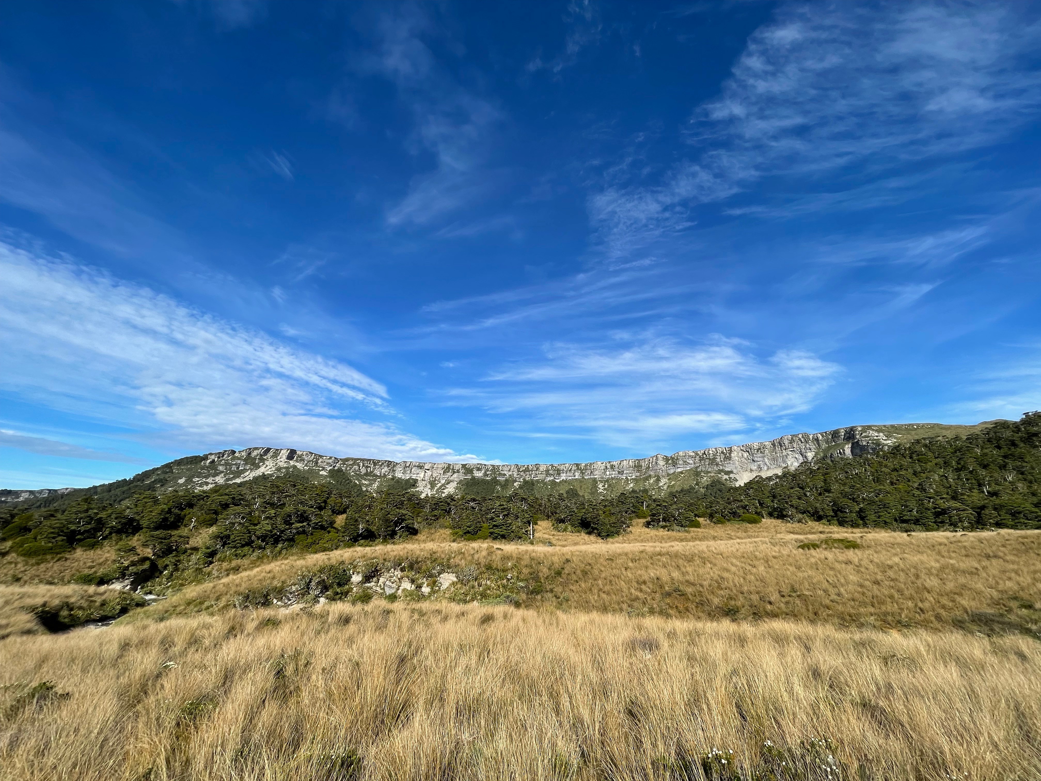
The next section of the ascent took us up another 300m to the border of the plateau, which also happened to be the high point of the journey at about 1111m. From here, the forest started to open up before giving way to the Thousand Acres Plateau, and a view of the still-distant Needle and Haystack peaks. Despite being a plateau there were still plenty of rolling contours to deal with, and Poor Pete’s Hut was visible at the edge of a wide depression, nestled among some sparse vegetation. Arriving at the hut after a short, easy-going descent we had a well-earned lunch break. As I had inferred before the journey, Poor Pete’s Hut had no water so we were glad of the decision to carry extra water-bottles.
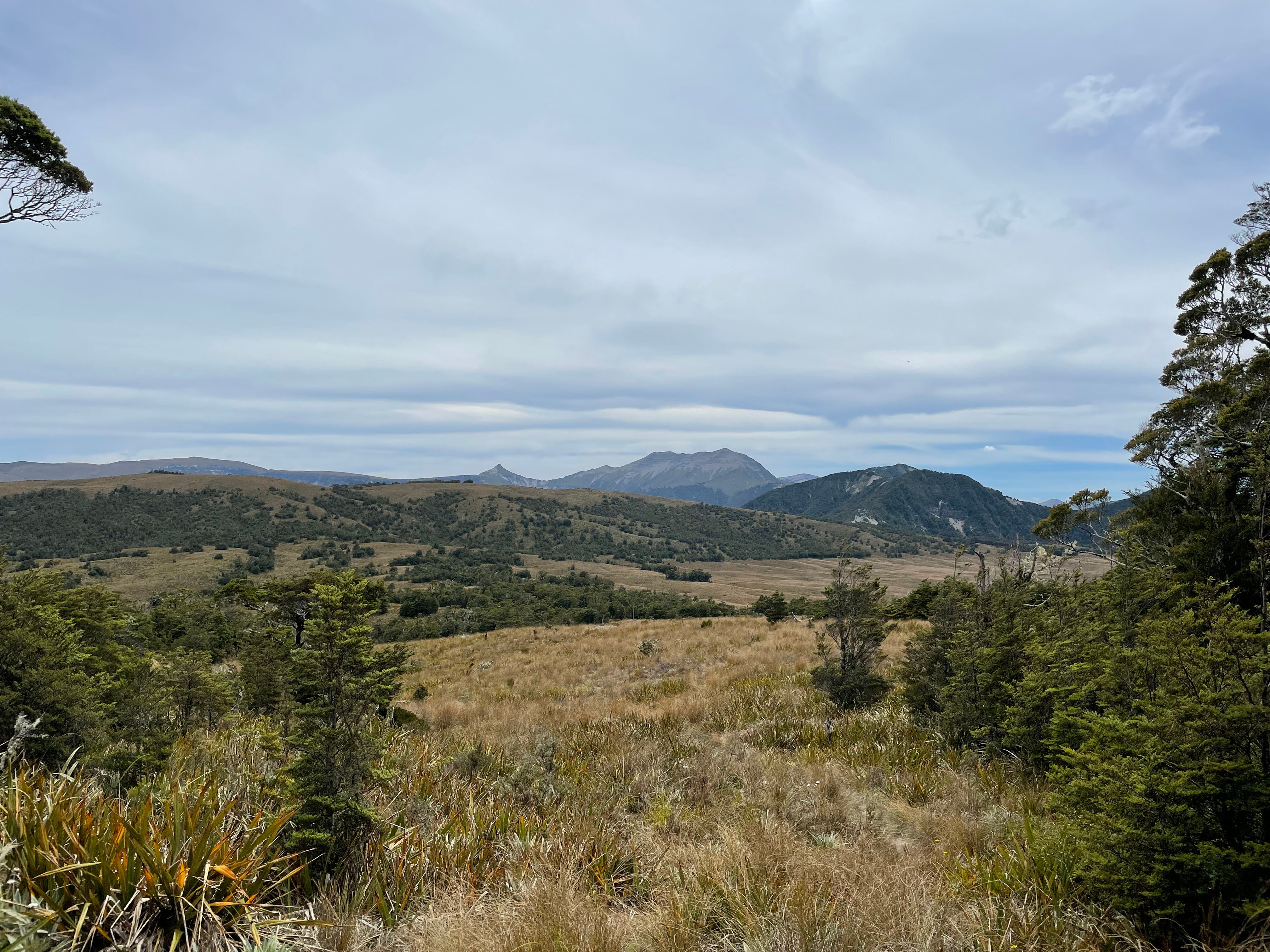 Can you spot Poor Pete’s Hut?
By this point it was about 1:30pm, and the wispy clouds were doing little to stop the hot sun from baking the plateau—and the people who foolishly chose to be there! Setting off from the hut, there was a short-but-sharp ascent to another high point, then a long trudge across the bumps and dips of the plateau. The trail featured some neat views west towards Kahurangi National Park, and the path was occasionally punctuated by creeks that had sharply eroded into the soft stone of the plateau, leading to some quite interesting geological rock-chute features.
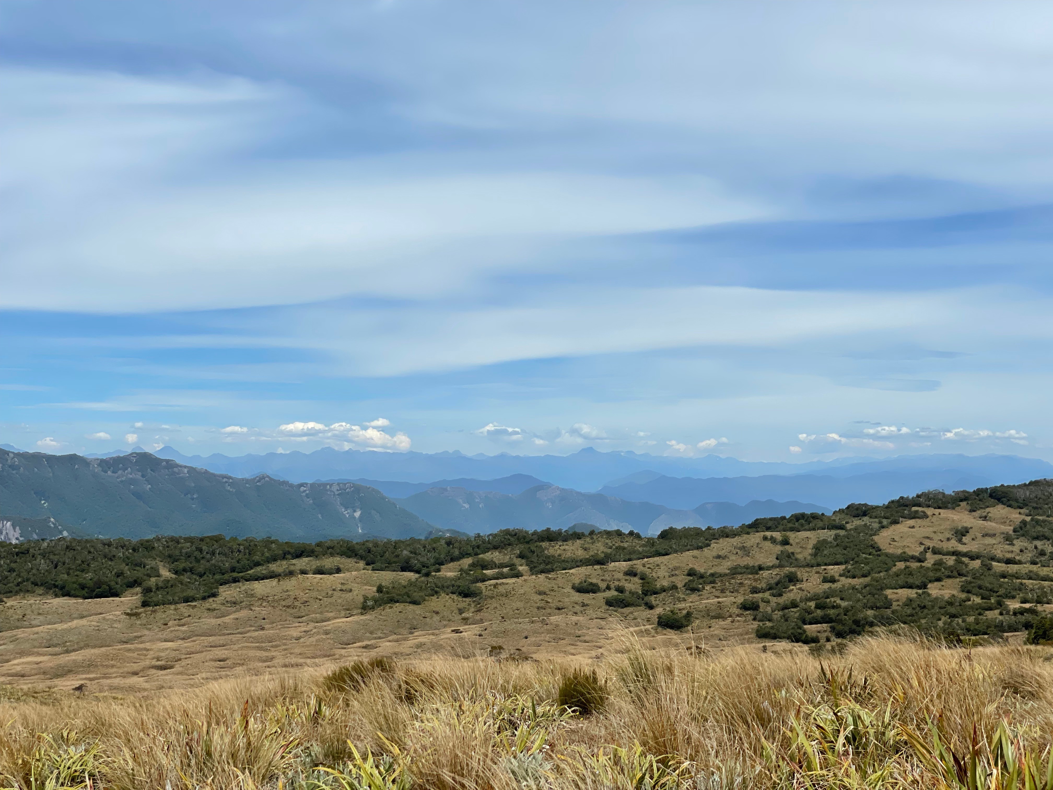 The many ridges of Kahurangi National Park
As we got closer and closer to the hut, the trail left the scrub of the plateau and started heading into vegetation—at first sparse, then getting denser as we approached our destination. Some mud and tripping hazards kept things interesting, particularly when we were nearing the end of our water supplies and energy levels!
After all the mental preparation for the slog, the hut seemed to appear quite quickly—one moment it seemed kilometres away, then suddenly it was only a few hundred metres away. And sure enough, after rounding a corner out of the forest and into a scrub-covered clearing, the hut appeared on our right below a magnificent rocky wall stretching up behind it. After taking off our boots, our main priority was to rehydrate—completely draining our drink bottles along with some electrolytes to assist with the process.
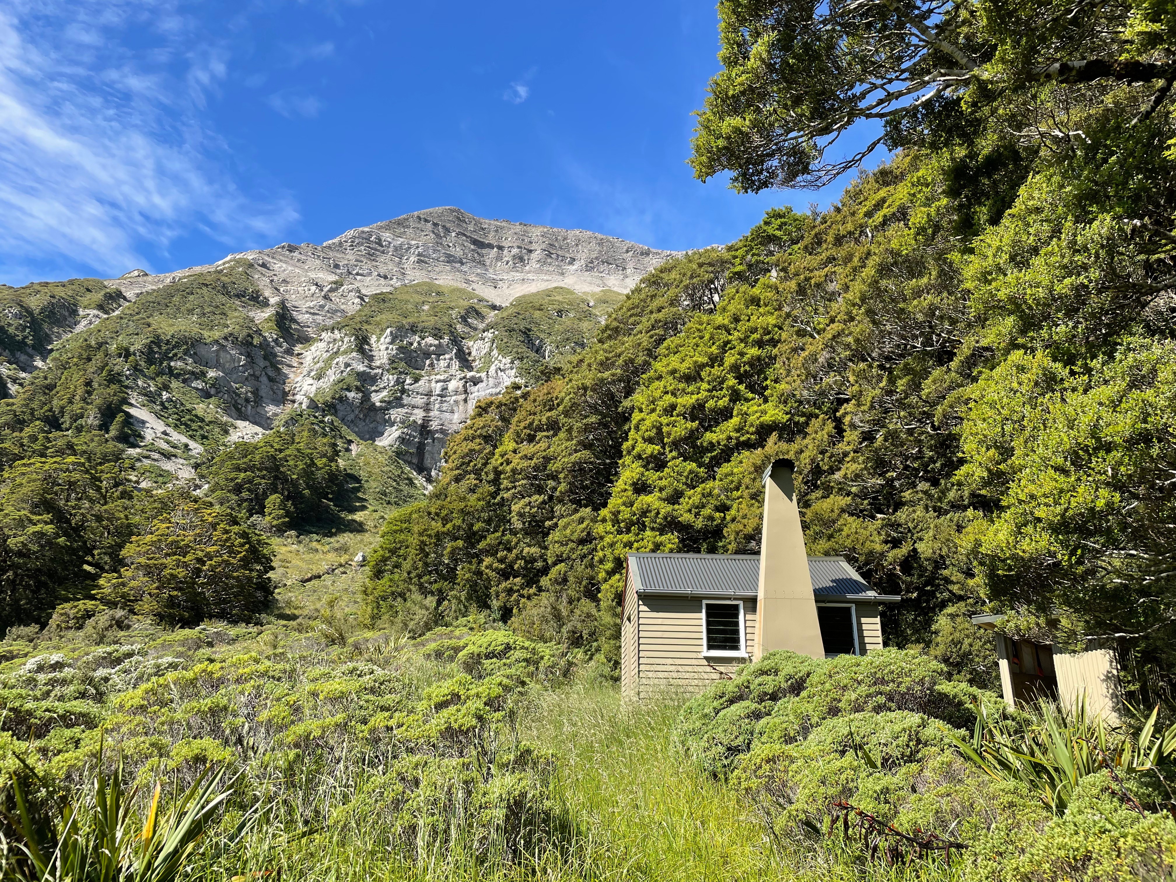 A welcome sight
As per usual hut routine, I had a read of the hut book over some snacks and drinks. According to multiple comments, there was a neat creek near the hut full of natural waterholes for a quick dip, so naturally we had to investigate! After confirming with the group of people who were camping across the clearing, we followed the creek bed as it wound its way across the scrubby clearing. The water in the creek was super warm, a by-product of it being relatively shallow and flowing over flat, sun-heated rocks. Unfortunately these same flat rocks were often covered in an invasive, treacherously slippery weed—so we had to be careful where we stepped. After a few minutes of walking the creek suddenly ended, dropping off a cliff into a wide, forested valley—a stunning view, and a highlight of the trip.
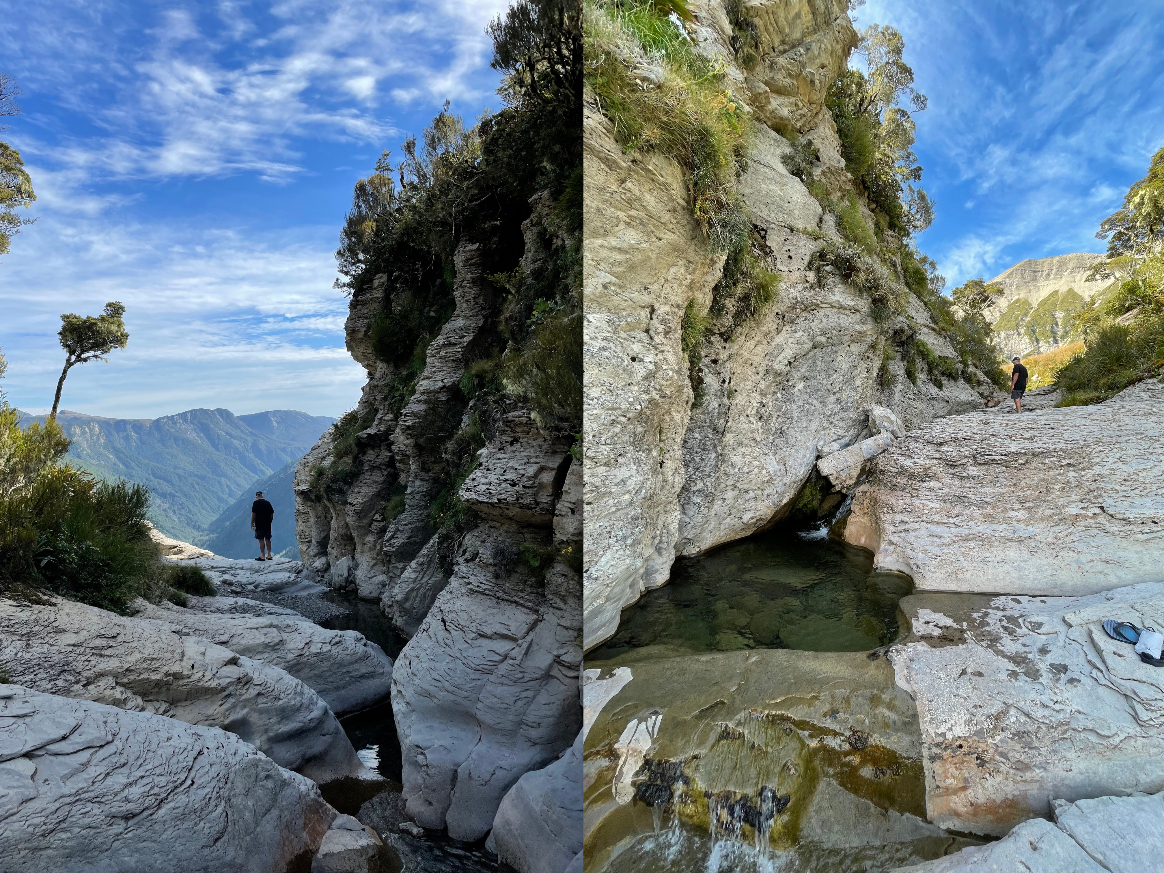 Dad and the creek, looking south then north
After freshening up in the creek, it was back to the hut for a basic tramping meal, then off to bed. The hut itself was basic, but in good condition thanks for the efforts of the Backcountry Trust who had refurbished it in late 2020.
Being a there-and-back trip, the next day was rather predictable—though this time we managed to escape the plateau before the day got too hot. The blue skies and different sun angles presented another opportunity for photos, including a great view of the so-called Devil’s Dining Table just west of the hut.
 The Devils Dining Table
Naturally, we had to detour via one of the hydroelectric intake structures, just to see what it looked like. Here’s a photo:
Overall, a great tramp to do for my last Aotearoa-based tramp for a while—even if I had to apologise to Dad for underselling the steepness of the ascent. My recommendation if you’re keen to take it on is to make sure you have plenty of water, and also allow for a whole day at the hut to explore the nearby peaks and plateaus. From what we heard, there’s plenty of speargrass on the way up—so don’t forget your gaiters!
Useless stats: ~35.6km total, ~1559m ascent