Te Araroa 2020/21
From mid-September 2020 until early-January 2021 I walked the length of Aotearoa/New Zealand with Karen, a friend who also found herself unexpectedly back in the country after overseas plans were abruptly changed.
What’s Te Araroa?
The 3000 km pathway known as Te Araroa (‘The Long Pathway’) stretches across Te Ika-a-Māui/the North Island and Te Wai Pounamu/the South Island. The official trail includes four ‘breaks’ in the continuum: Raukawa/Cook Strait, Rakaia River, Rangitata River and Lake Wakatipu. The aim for us was to go by ‘human power’ (walk, cycle, canoe, kayak) for as much of it as reasonably possible—we ended up doing 3075 human-powered kilometres over the course of our 107 day journey:
- 2321 km walking
- 638 km cycling
- 116 km canoeing/kayaking
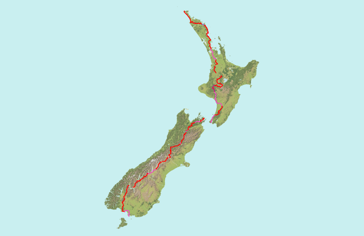 Where we walked, cycled, canoed or kayaked (Basemap: Geographx, CC BY 3.0 NZ)
Map
Check out the full map of our journey—the whole thing was GPS tracked, because I’m a geography nerd.
Trip log
I captured the experience by ‘one photo per day’ with short(ish) trip logs and GPS tracks.