Trip Report: Crow Hut via Avalanche Peak
A few months back, myself and two others (Karen and Joe) thought we’d take a weekend in late May to go for an overnight alpine tramp before the real winter temperatures hit. So, despite a rather dubious forecast we set out for Arthur’s Pass village on the Saturday morning. Our arrival in the village meant a quick coffee stop, followed by a visit to the local DOC visitor centre—at the time operating out of the back of a motel because of the earthquake risk to their usual headquarters. Having neither crampons nor ice axes, we collectively mused over the amount of snow likely to be found on the tops and the significance of the clouds swirling around high above. After some umm-ing and ahh-ing, we decided to at least begin the walk up—best case, we tramp as planned; worst case, we do a day trip up Avalanche Peak with heavy packs!
The route
Sufficiently caffeinated and moderately enthused about the steep gradient ahead, we began our ascent to the peak via Scott’s Track—the shorter, but sharper of the two options. As is typical for tramping, barely 30 minutes had passed before we’d stripped off most of our outer layers despite the chilly temperatures! Climbing above the bush line, a short chocolate break in the howling wind meant the return of the rainjackets shortly before the final approach to the ridgeline. What began as sparse, discoloured patches of snow was rapidly morphing into a continuous layer, draped over the shady areas of the landscape. Despite the occasional mis-step, the approach to the snowless ridgeline was uneventful and the summit was rapidly reached.
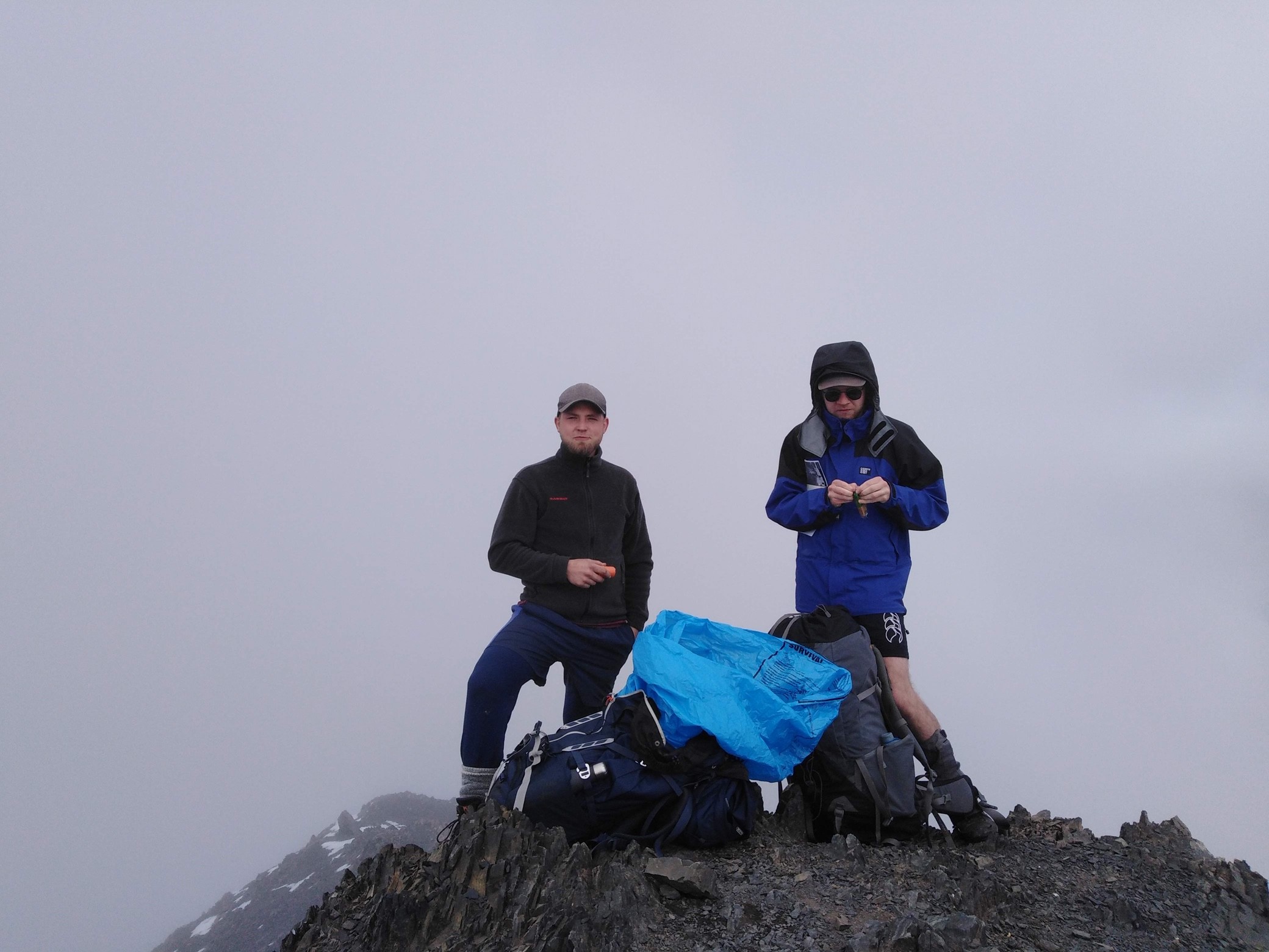 A quick lunch break at the summit of Avalanche Peak
A 1pm arrival at the summit meant it was time for a brief lunch stop, hurried along by fast-descending body temperatures and the fact that another larger party also appeared to be en-route to the 10-bunk Crow Hut. Counter-intuitively, the route to Crow Hut begins by heading south—despite the desired ridgeline being prominently visible from the summit heading north. With some trepidation caused by the ever-changing alpine weather and the patches of snow on the mountain’s southern aspects, we began our descent from the summit. Following the vague paths left in the shattered grey rock in of the southern ridge by the party before us, we continued down and around the summit of Avalanche Peak, balancing delicately in small depressions in the shards of rock and patches of greyed snow above the steep scree slopes, ultimately emerging onto a small saddle to the west of the peak.
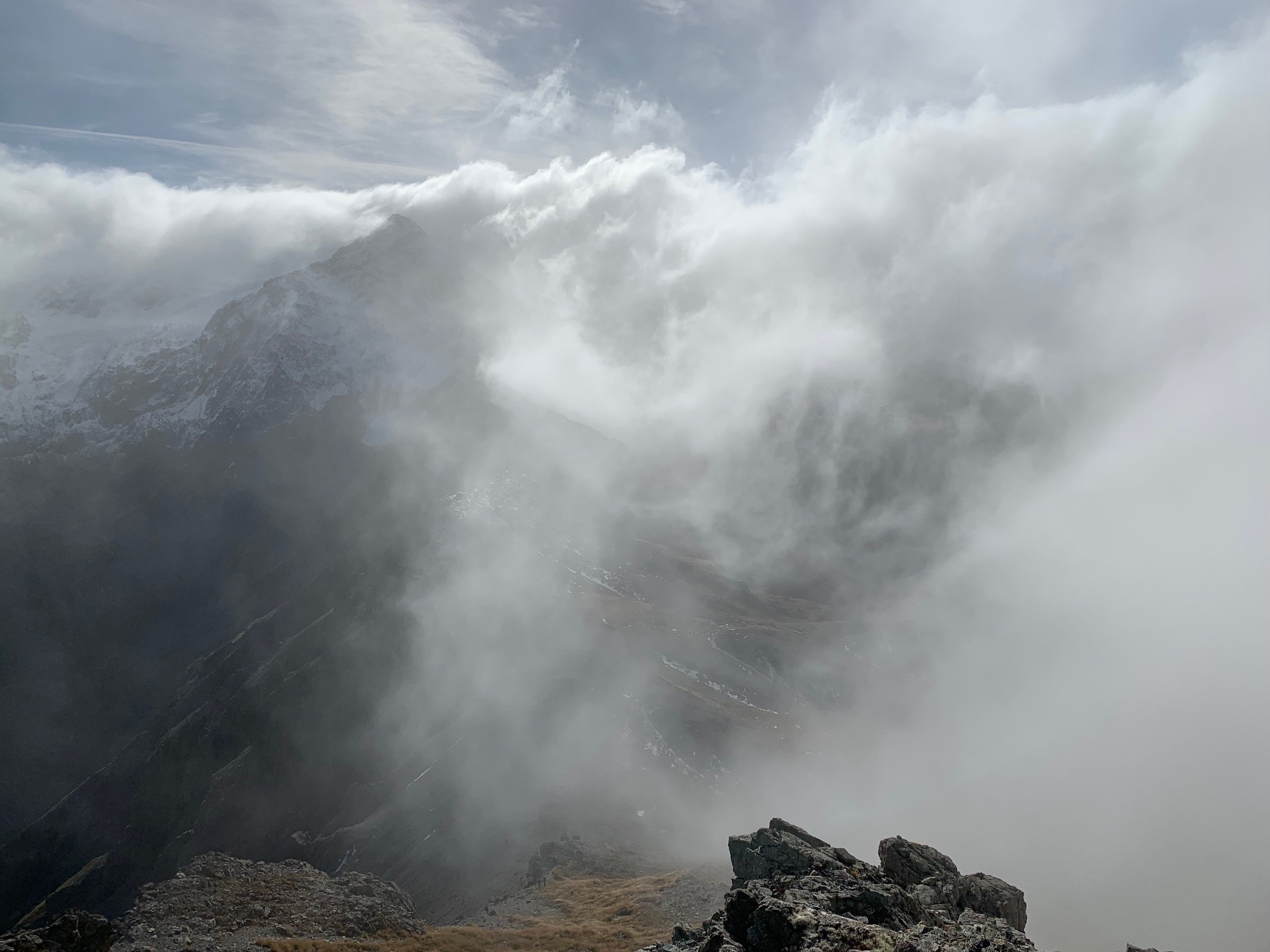 Looking down the ridge from the saddle just west of Avalanche Peak
A very short sidle from the saddle led us on to the ridge. At this point, the route guide1 was very specific on how you can tell which gravel slope to use to descend into the Crow valley:
- The point is marked by stakes and a rock cairn
- You can see the full length of the scree, from the ridge to the Crow valley
- The full drop of Devils Punchbowl Falls is visible on opposite slopes
- Just after the correct place to descend, the ridge you are on rises more steeply towards Mount Rolleston
Descending down any prior gravel scree slopes would apparently lead to some bluff-type problems.
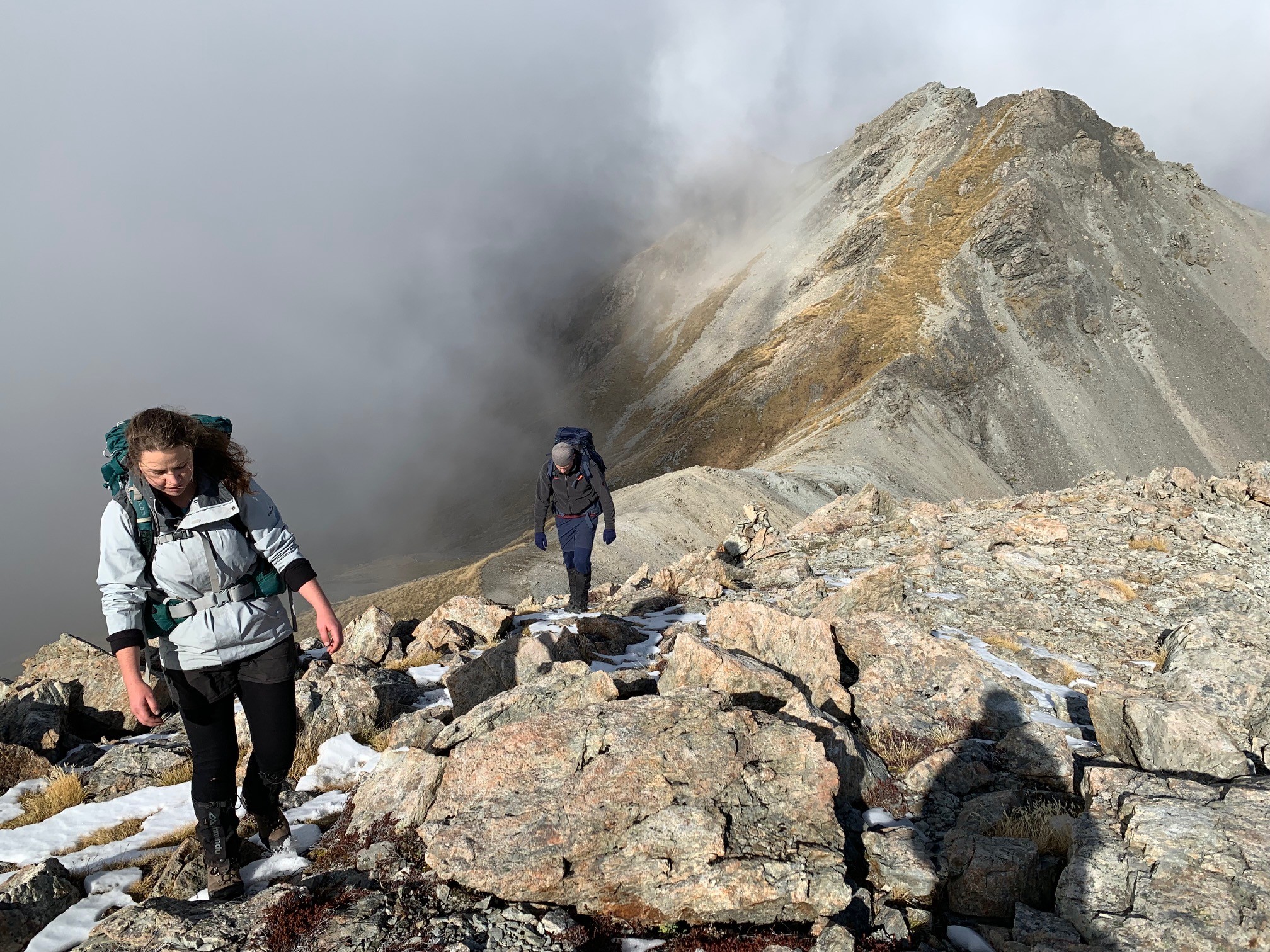 Karen and Joe descending the ridge, shortly before the point at which the scree slope begins (photo looking south)
Sufficiently warned, we continued along the ridge, passing the other group who had stopped for a lunch break in a spot out of the wind. Our walk along the ridgeline offered striking mountain views, with the swirling clouds only adding to the experience. As it turned out, the point at which we were to descend the scree slope turned out to be very obvious—however, reading the hut book later that day would suggest that some still went down the wrong screes, despite the specific criteria!
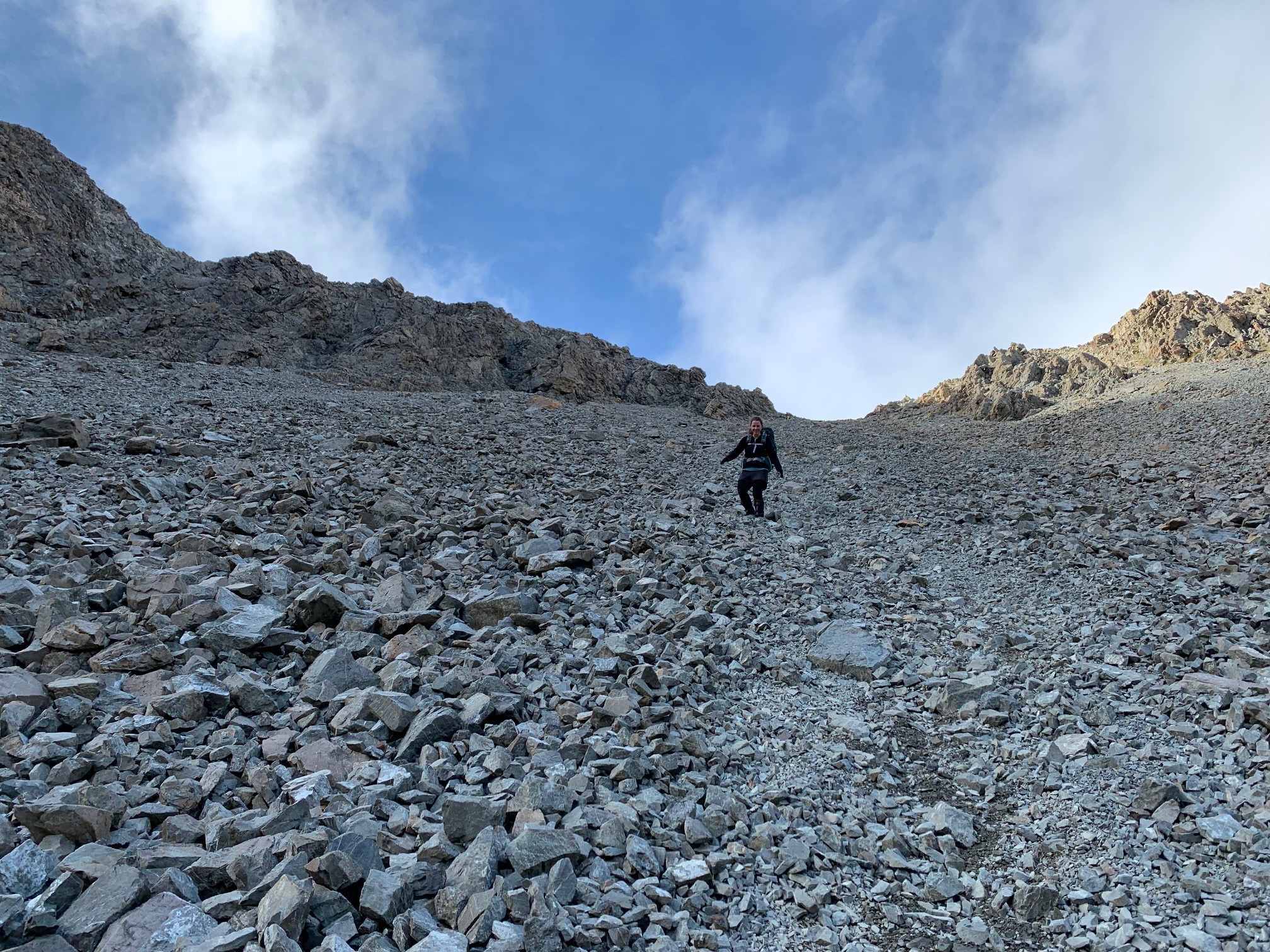
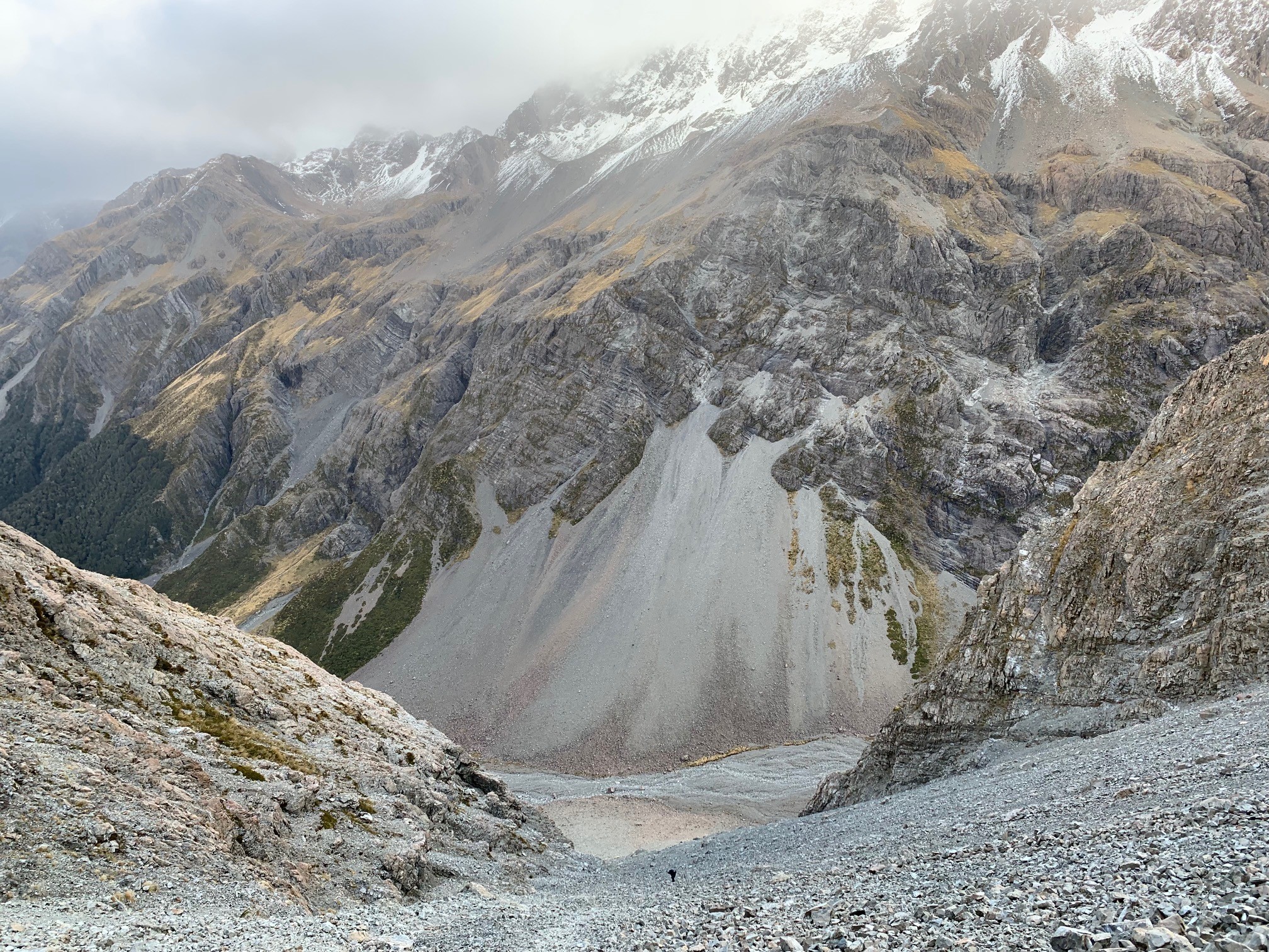 Looking down the scree slope into the valley—can you spot the person?
Descending the scree slope itself was quite a mixed-bag—some very lumpy, bouldery sections but also some (short) quality scree running sections. Nonetheless, it was quite an efficient way to descend 600m.
 Karen choosing her lines through the scree slope
Upon reaching the valley floor all that was left to do was the short 25 minute walk to the hut, the rugged grey floor of the eroding glacial valley rapidly morphing into scrub, tussock and forest. We were even lucky to be accompanied by the cries of a kea circling high overhead, just a few minutes out from the hut.
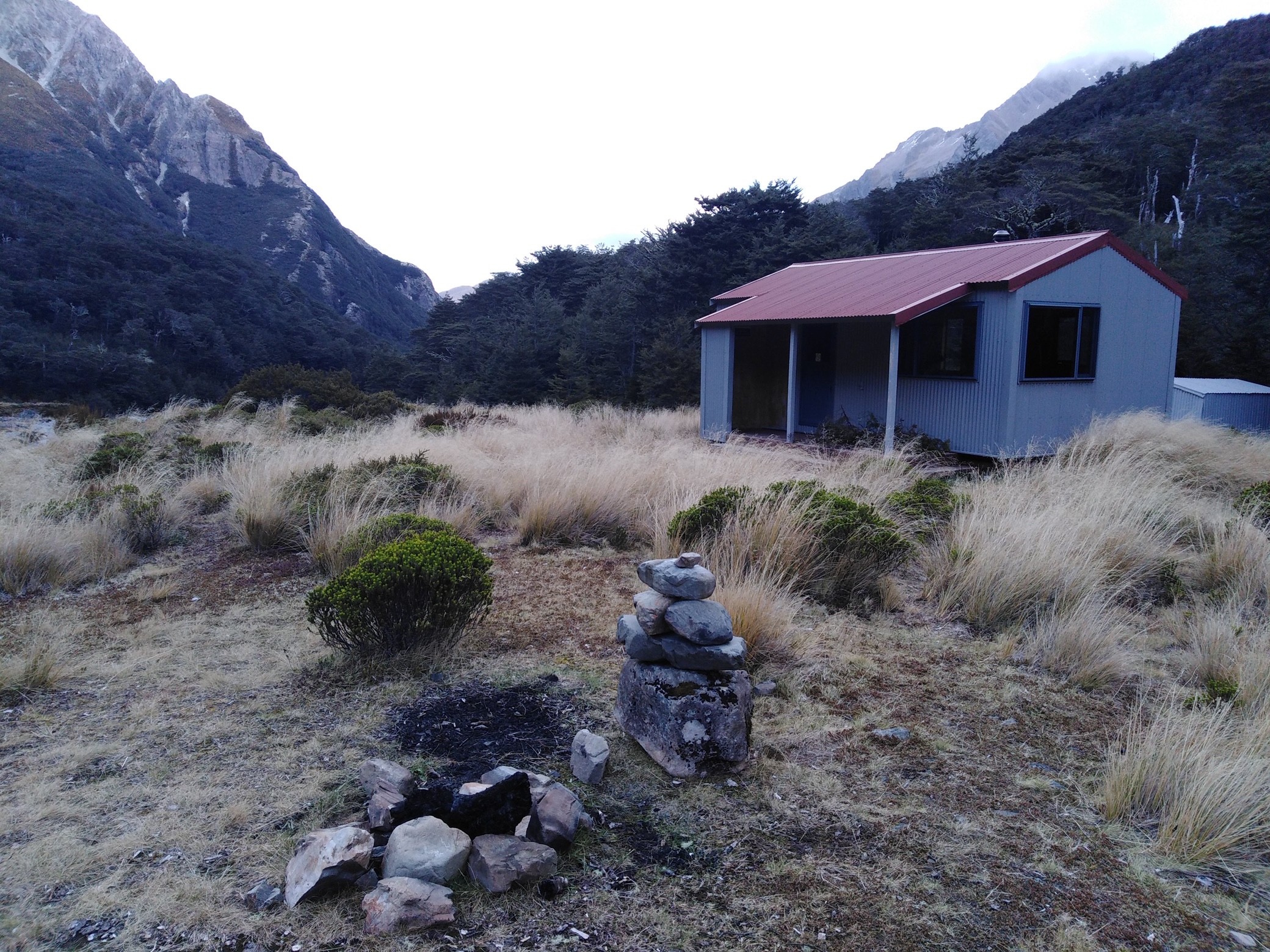 Reaching Crow Hut, looking south
Our destination successfully reached, we set about the usual routines—getting the fire going, fetching water from the nearby river, making hot drinks and laying out sleeping bags. Soon enough, the first of the party we met on the tops began to arrive shortly followed by the rest, accompanied by their mates who had walked up the valley—quite a few people for a ten bunk hut! Fortunately, a few of them had planned ahead and opted for a night under canvas instead of the alternative option of being jammed into a warm albeit stuffy hut. The evening passed in a relaxed fashion, with a couple of cross-party games of Werewolf passing the time.
The next morning, we set off from the hut around 9am hoping to avoid the worst of the rain scheduled to arrive that day. The Crow valley proved to be a pleasant walk, with gentle downhill gradient combined with a good mix of forest, river flats, rocky slips and river crossings. Despite the crossings, Joe managed to keep his feet mostly dry, in contrast to Karen and myself!
Following the trail as it cut through a corner of mature beech forest, we ended up on a wide grassy river flat beside the seemingly distant braids of the Waimakariri River. Our arrival on the flats was complemented by a majestical rainbow stretching down the river valley.
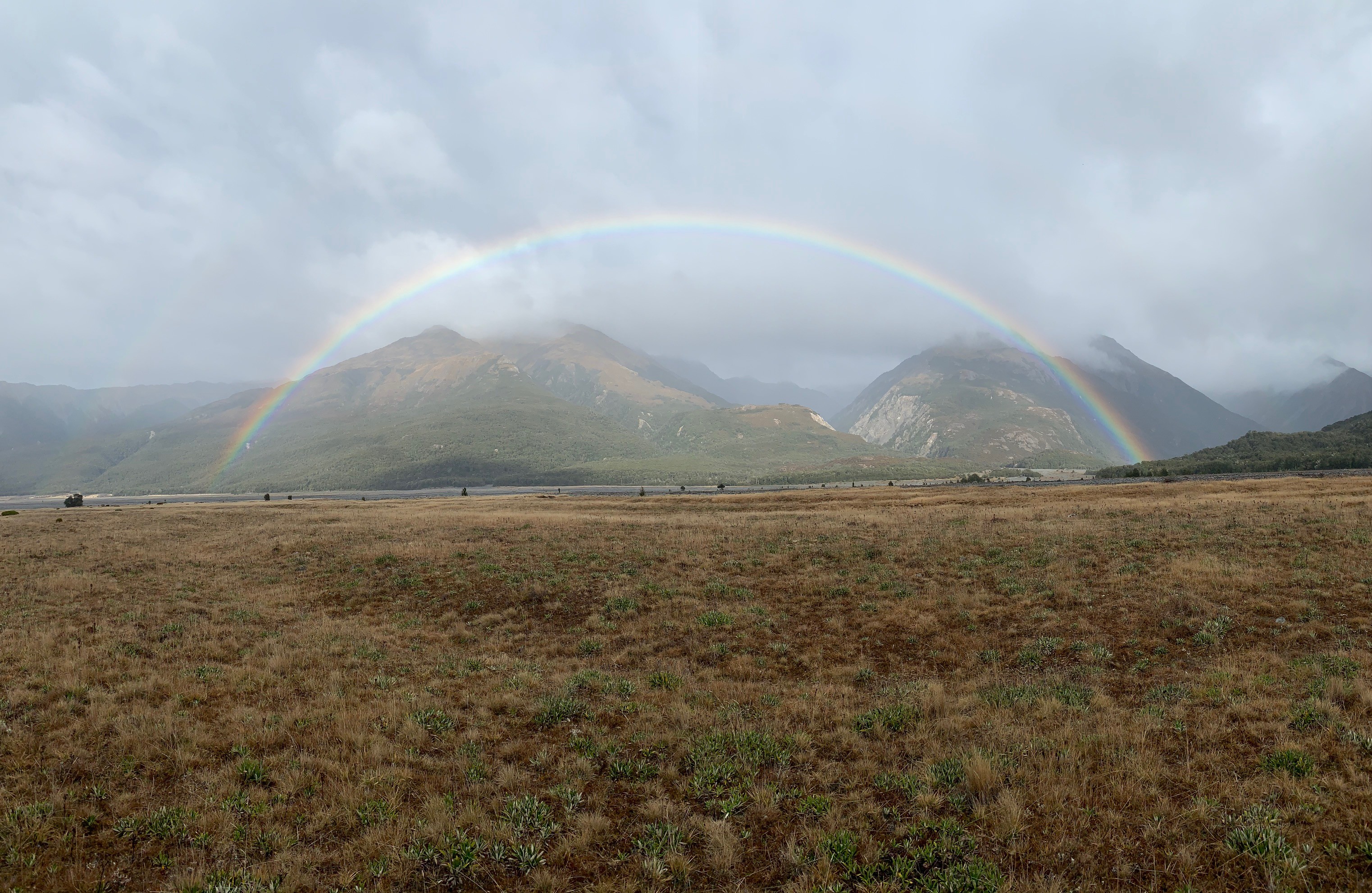 The rainbow above the Waimakariri River (looking south)
The river flats soon gave way to the rounded rocks of the river bed, with the monotony of river bed travel broken occasionally by a branch of the river wending its way from one side of the valley to the other. After a while, we reached the 4WD track on the true left of the Waimakariri which ultimately led us back to the main highway, marking the end of our trip. A quick change from tramping boots to Crocs, and soon enough I was out on the highway, thumb sticking out trying to get a lift back to our vehicle in the village. It’s always interesting to ponder who might stop for you, but I was nonetheless surprised that an expensive looking black Mercedes pulled over. A quick chat to its middle-aged owners soon provided the answer—they were both keen trampers in their youth, and knew what it was like to be cold and damp waiting for someone kind to help get you back to your car! In typical New Zealand style, whilst barely a few kilometres separate Arthur’s Pass Village and our end point, the weather was quite contrasted—heavy rain in the pass, compared to light drizzle at the waiting point. Safely dropped-off in the village (in the heavy rain), all that was left to do was pick up my rapidly-cooling friends on the side of the road! Overall, an excellent way to pass the weekend.
Useless stats: ~19.4km total, ~1202m ascent