Trip Report: Wangapeka wanders
Easter 2019 brought about the second attempt at walking the Wangapeka Track, after an aborted attempt a few years ago due to heavy snow and windfall. Here’s how it went.
Day One
After reading the DOC alert for a ford on the road—“the river is flowing over the ford, even at low water levels”—we successfully convinced family friends with a 4WD to drop us at the eastern end of the track. Suitably cautioned, we ventured over the river banks with our friends in their 4WD to find a completely dry and flat concrete pad.
With the drama of the ford out of the way, and a few obligatory group photos taken, we started down the trail and over a swingbridge.
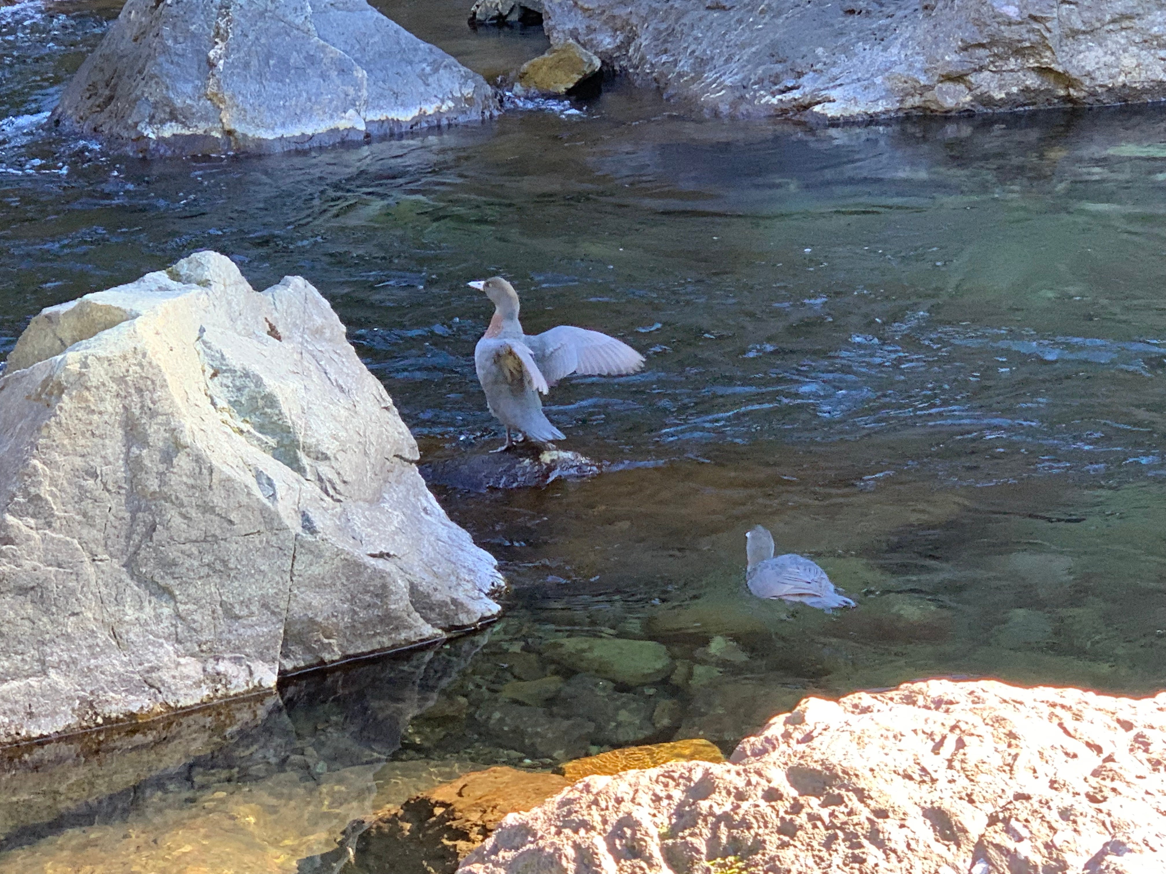 Two whio in the Wangapeka River
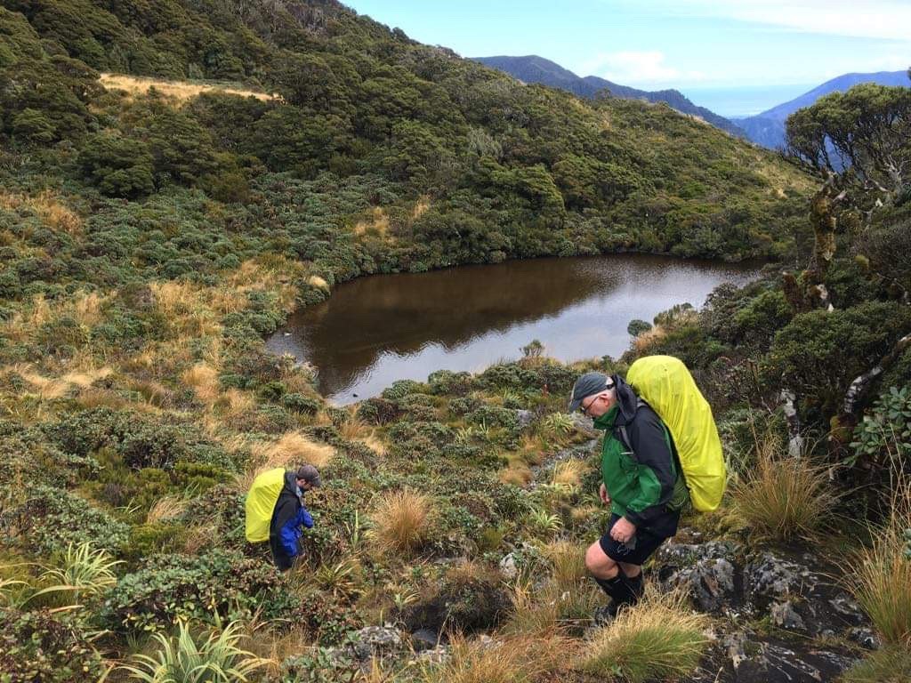
The Wangapeka Track to Stone Hut is maintained to a ‘track’ standard, and was a gentle climb following the crystal-clear Wangapeka River. Highlights included the characterful Cecil Kings Hut, the geomorphically impressive landslide lake complete with still-standing dead trees, two whio, and a warm hut awaiting us as the sun went down. An evening of liar dice, whio calls and hot drinks proved to be a winning combo, leading to a mostly comfortable night’s sleep (some snoring notwithstanding).
 The landslide lake (Credit: The old man)
Day Two
Day two began with a short climb up to the top of the Wangapeka Saddle, then a track that gently wiled its way down to the headwaters of the Karamea. At this point, the track was now considered to be a ‘route’, meaning that where slips had happened, DOC’s solution was to simply nail orange markers on trees in a straight line up until you were high enough to go past the top of it. Highlights of this section were a couple of three-wire bridges and more whio. The lowlight was slipping on a large rock, solidly thwacking my knee but fortunately missing a pack-aided face-smash by a few centimetres.
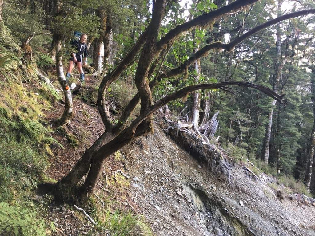 A DOC-engineered solution to a slip (Credit: The old man)
Arriving at Helicopter Flat Hut meant lunch and the appearance of raindrops. Jackets donned, we continued on the track as it roughly followed a contour line, with DOC providing helpful chains where none were necessary, and no chains where they would’ve been helpful. Descending promptly to the Taipō River, we crossed another swingbridge to the true left. With the rain now well bedded-in, we trudged our way up to the Taipō Hut arriving late in the afternoon, the darkness belying the true time of the day. With the smell of smoke in the air and wet gear hanging on the hooks outside, we stumbled into the small verandah, removed our boots and made ourselves at home within the spacious hut. The usual routine of dinner, hot drinks, fire babysitting and card games was only interrupted by clumsy dashes to the uncovered water tank when breaks in the rain allowed for it.
Day Three
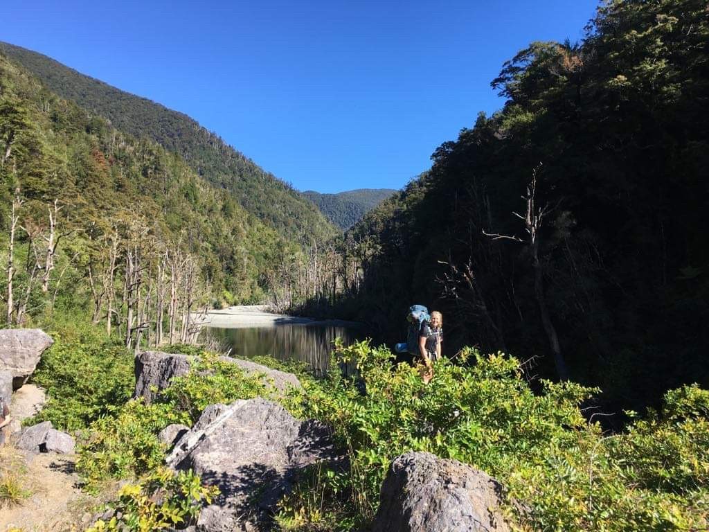
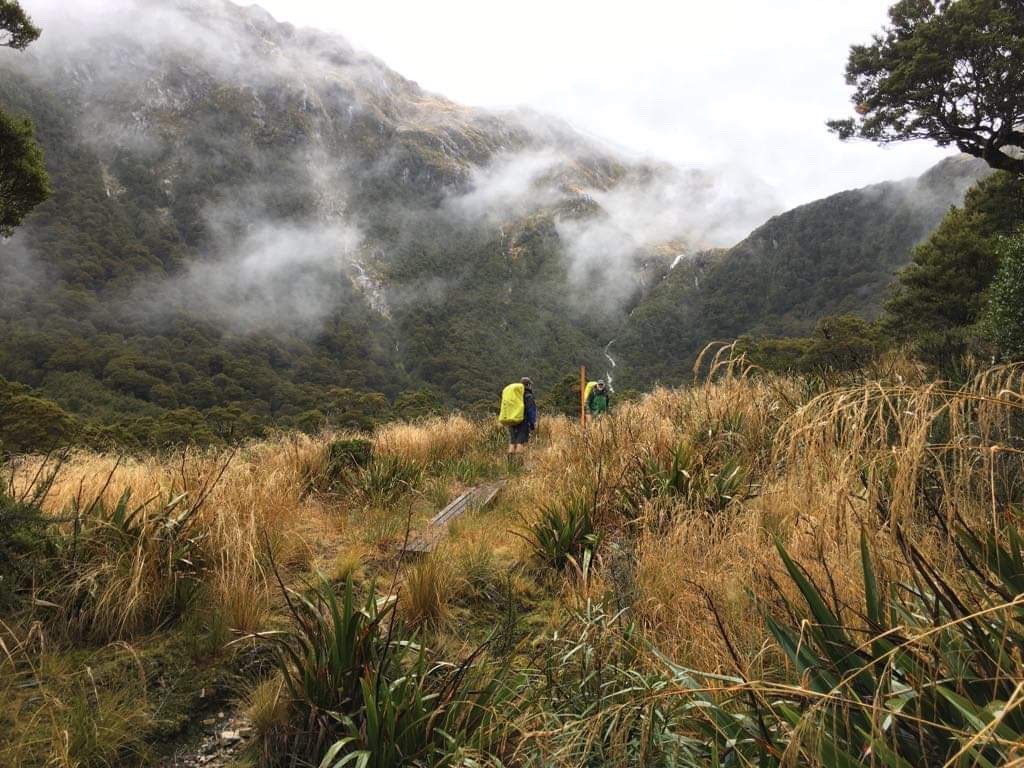
Day three was a leisurely start, with the sibling (a morning lark) attempting to motivate me (a night owl) out of my warm sleeping bag. With my unsuccessful excuse of waiting for the rain to clear, we set off down the sodden track/spontaneous-creek-bed on the short-but-sharp ascent to Little Wanganui Saddle. The saddle arrived with surprising promptness, the forest suddenly giving way to the only above bushline part of the whole trip. Timing our arrival perfectly with receding rain clouds, we took the opportunity to take a few photos amongst the melange of shrubs and mosses with views of the Tasman Sea, before beginning the descent to the Little Wanganui River valley. With the occasional waft of goat in air, the descent to the Wangapeka Bivouac was mostly uneventful, barring a hilarious slip by the old man in his attempt to shake the water off a wet tree above me.
 The approach to Little Wanganui Saddle (Credit: The sibling)
Lunch was spent in the sun, accompanied by a certain ‘eau des goats’, salted caramel easter eggs (consumed) and a weka (not consumed). Suitably satiated, a swingbridge marked the beginning of a giant’s boulder playground, with mossy boulders, fallen trees, awkward slip diversions and sketchy crossings of creeks with slippy banks and dodgy stones. And more goats.
Belltown Mananui Hut crept up on us surprisingly fast, and a very comfortable stay was to be had. The hut was clean and well-positioned with a good stock of firewood, plenty more hot drinks and a few rounds of cards. Joined by a couple of couples from the night before, after more discussions it turns out that I’d met one of them in the past in Arthur’s Pass whilst on a kea mission—a good reminder of how small the outdoor community can be!
 Descending from the saddle (Credit: The sibling)
Day Four
Day four began like the others, with my nicely-prepared porridge going cold for the third morning in a row, and my incoherent semi-conscious utterances captured by a certain feckless sibling armed with a phone camera. Setting off in the very welcome sunshine, the trail continued in the same style as the day before, before reaching a large flat area full of regenerating forest punctured by tall, narrow rimu trees. Following the easy, flat, benched trail (an ex-access road) winding away and then back to the river lulled us into a false sense of security, which was rudely shattered by the last 1.5 kilometres of dodgy slip-affected trail. In places, the trail was barely clinging to the edges of the fast-flowing Little Wangapeka River—now no longer a mountainous trickle but rather a full-blown West Coast river, coloured in stewed-tea brown. Finding a car at the end, complete with mum and homemade biscuits was a nice way to finish the tramp.
Upon jumping on the highway to Westport, a number of the oncoming vehicles began flashing their lights at us—as it turns out Mother Nature wasn’t done with us yet. A slip had cut-off the highway, which mum must’ve thankfully narrowly avoided on her journey earlier in the day. There are certainly worse places to be stuck than the Karamea basin, so a relaxed lunch was had in Karamea proper whilst we waited on the slip to be cleared—according to one local, the timing of which was somewhat dependent on whether the local contractor had been at the pub last night or not. That day it seems we were in the clear, so after a few hours we were on our way back home.
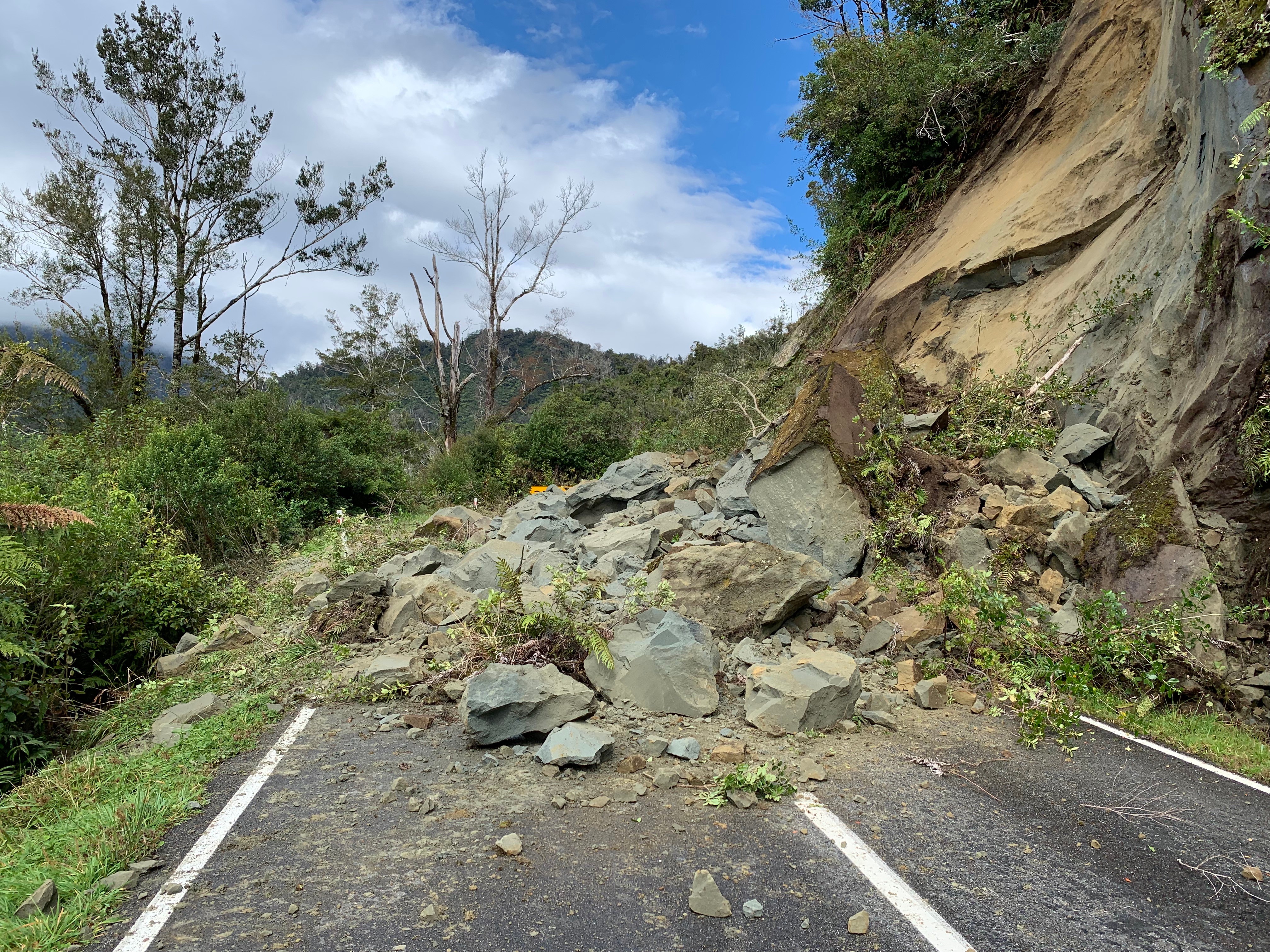 The slip
Reflections
The number of whio we heard and saw is a testament to the 1000s of traps and other predator control completed by DOC and volunteers with the Whio Forever programme—it’s very cool to be able to see the results of a sustained predator control programme!
The most surprising aspect of the trip was the accuracy of DOC times—under normal circumstances, we’d have expected to get to a destination in 2/3rds of DOC time (despite tramping with the old man). Arriving roughly at the suggested DOC times was a novel concept to us!
The route
Useless stats: ~59.8km total, ~2029m ascent